You are here
Cross-sectoral
Share
External Related Links
United Nations Convention to Combat Desertification
Keywords
Authors/Partners
World Bank Latin America and Caribbean Region, Corporación Nacional Forestal (CONAF)
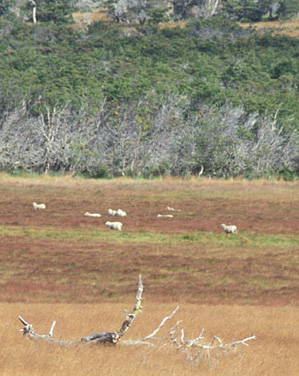
Chile: Forests, Trees and Conservation in Degraded Lands
CHALLENGE
Chile is one of the most developed countries in the southern hemisphere and relies heavily on its natural resource base for employment and exports. Yet, despite its natural assets and economic prowess, the country is plagued by serious land degradation problems including desertification, accelerated soil erosion, and forest degradation. In addition, climate change is exacerbating land degradation through changes in rainfall quantity and regimen, and the melting of glaciers, which are critical for the country’s water supply.
An astounding two-thirds of the national territory (48 million ha) are affected or threatened by desertification and drought (CONAF 2006). Of the 1.3 million people inhabiting these areas, about 60 percent live in poverty. The main causes of desertification and land degradation in Chile are due to overgrazing, farming on marginal lands without conservation practices, and over-exploitation or poor management of forests. In fact, about half of Chile’s 15.4 million ha of forests are already degraded. Forest degradation is advancing at about 77,000 ha annually, and occurs mainly in the southern forests, where fuelwood extraction is a major contributor to the problem. Despite this alarming situation, there is only an emerging awareness regarding the degradation issues, and the country has yet to make significant advances to counter land and forest degradation. Urgent steps are needed to align country policies and programs to tackle the problem, provide technical guidance to field workers and heighten awareness nationwide.
APPROACH
The main objective of this activity is to provide state-of-the-art knowledge to the Chilean Government and other stakeholders on best practices and guidance for restoration of degraded lands through forestry applications suitable in the Chilean context.
This knowledge activity supported by PROFOR would include:
- a review of the many pilots and ad hoc experiences in Chile to restore degraded lands through forestry (including economic, social and environmental benefits);
- an analysis of the investment returns of select experiences, to demonstrate that the reversal of land degradation, climate change mitigation and the generation of income can be achieved simultaneously under specific conditions;
- a projection of the carbon sequestration potential for afforestation and reforestation of degraded lands in appropriate areas throughout Chile;
- a proposal for a monitoring system that would track desertification and progress in remedial efforts to address land degradation;
- outreach and awareness building activities on the scope and impact of land degradation and remedial measures needed to slow its advance, especially those related to forests and trees.
RESULTS
This activity, approved in June 2011, is ongoing. Findings will be shared on this page when they become available. Follow us on twitter or join our mailing list for regular updates.
For stories and updates on related activities, follow us on twitter and facebook, or subscribe to our mailing list for regular updates.
Author : World Bank Latin America and Caribbean Region, Corporación Nacional Forestal
(CONAF [1])
[1] http://www.conaf.cl/conaf/index.html
Last Updated : 02-24-2017
Share
Related Links
Get Forest Smart: PROFOR 2016 Annual Report
External Related Links
World Bank Group Steps Up Forest Action in Support of Development and Climate Goals
Six Global Forest Goals agreed at UNFF Special Session
The 2017 Atlas of Sustainable Development Goals: a new visual guide to data and development
Forest-Smart Strategies Are Taking Off
By Werner Kornexl
The more we know about our rapidly changing environment, climate, and demographics, the more we learn about how critical forests are for our resilience, overall wellbeing, livelihoods, and economies. Unfortunately, in a world of budgetary constraints and competing interests, governments face increasingly complex decisions when it comes to supporting different sector priorities. The solution is to move away from the traditional approach of sectors operating in isolation or in competition with one another, and more towards an integrated win-win approach. But how?
There is, in fact, increasing evidence that thinking across sectors makes the most convincing business case for forests and for sustainable economic growth, job creation, and poverty alleviation, all at the same time. At the World Bank’s Program on Forests (PROFOR), this cross-sectoral thinking is called “forest smart.” At its core, the forest-smart approach entails maximizing the benefits from development investments, while minimizing the negative impacts to forests and forest biodiversity (See more about this in PROFOR’s 2016 Annual Report and the World Bank’s Forest Action Plan).
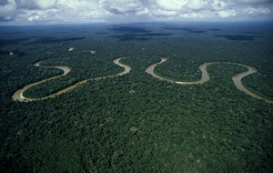
The case for a combined forest conservation-and-production approach becomes even stronger as we see the performance of other sectors being affected as a result of environmental stress caused by deforestation. For example, traditional agricultural production and hydropower generation are under growing pressure from unsustainable practices, leading to further temperature increases, and extreme precipitation patterns. Recent PROFOR research even suggests that a downward spiral of droughts, vulnerability to fire, and improper land-use practices could lead to a point of no return for the Amazon rainforest - with likely devastating implications for water resources, crop production, and people’s ways of life across an entire continent.
At the same time, there are already some powerful financial arguments for why other sectors should not only think about forests when planning their activities, but actively become forest champions. Consider the energy sector: in China, maintaining a forested watershed significantly reduces sedimentation around the Three Gorges River hydropower plant, resulting in savings of $40 million every year. Forest-smart thinking is also relevant in the water sector, where the economics of water supply speak a clear language. New York City, for example, saves $1 billion annually in water filtration costs by managing forests in the Catskills watershed, while Jakarta relies on Bogor’s forests for the city’s water supply and to control floods. And in the field of disaster risk management, governments increasingly recognize the value of including forests and mangroves, since grey infrastructure alone is unlikely to be either feasible or economically viable. In Vietnam, for instance, mangrove preservation avoids $7 million a year in flood prevention costs. In these and many other situations, forests may not have been the first consideration, but they ultimately provide the greatest co-benefits over the long-term.
In a sign of growing momentum, the forest-smart concept is being taken up in different fora. The latest meeting of the United Nations Forum on Forests (UNFF12), for example, included inspiring discussions on how forests can contribute to achieving the Sustainable Development Goals (SDGs) – not just the ones focused on forests and ecosystems, but also the ones linked to poverty, energy, food security, health, and water. In addition, the first-ever UN Strategic Plan on Forests, approved in January of this year, is a long-awaited and necessary step in linking forest services to other SDGs, and promoting cross-sectoral cooperation and financing for sustainable forest management.
The World Bank is resolutely supporting these efforts, not just through its overarching corporate commitments (ending extreme poverty and boosting shared prosperity, in a sustainable and inclusive manner), but also through direct initiatives like the new Atlas of Sustainable Development Goals, which tracks countries’ progress towards the SDGs and their related targets. The World Bank also supports more and more governments in applying forest-smart principles within larger landscape operations. This is the case in Indonesia and Mozambique, for instance, where land tenure, agroforestry, forest management, and forest conservation activities are harmonized under one landscape umbrella.
At PROFOR, we are committed to translating the forest-smart concept into actionable solutions, making it as straightforward as possible for policymakers and experts in different sectors to see forests as a viable and desirable component of their work programs. Our work includes:
- A PROFOR activity in the Republic of Congo resulted in an informed and participatory process that helped the government to better understand the economic, social, and environmental trade-offs of mining activities, and to work across ministries to align development initiatives.
- In Brazil, PROFOR and the BioCarbon Fund supported research into renewable charcoal production to help meet energy needs in the steel sector while reducing pressures on native forests.
- In Jamaica, ongoing research on the costal protection services provided by mangroves aims to guide government investment decisions around infrastructure, tourism, and fisheries.
- PROFOR’s activity on poverty is looking to tease out whether forests can provide not only a safety net for the poor, but also a pathway out of poverty.
The growing momentum for forest-smart strategies is encouraging and timely. Some 13 million hectares of forest are being lost every year, and many habitats are reaching critical tipping points, beyond which biodiversity and ecosystem services will be unable to recover. Whatever your professional sector, we can all play a role in being forest smart. But there is no time to waste – we must act now.
So what does forest-smart mean to you and your work? We look forward to your thoughts.
For stories and updates on related activities, follow us on twitter and facebook, or subscribe to our mailing list for regular updates.
Last Updated : 05-31-2018
Share
Related Links
Sectoral Report: Mining (April 2013)
Republic of Congo: Balancing Mining Development and Forest Conservation in the Congo Basin
Keywords
Congo Basin, Cross-sectoral, Green Growth, Land Tenure, Mining
Authors/Partners
World Bank Africa Region and World Bank Oil, Gas and Mining Policy Division (SEGOM).
Balancing Mining Development and Forest Conservation in the Congo Basin
CHALLENGE
Deforestation in the Congo Basin is expected to increase significantly in the future as investment in productive sectors grows. Thus, it will be essential to assist Congo Basin countries in ensuring that forestland development is planned and implemented in such a way as to avoid, minimize and/or offset unnecessary economic losses and social hardship and to draw optimal benefits from sustainable forest resource use. In 2013, the World Bank published a study on “Deforestation Trends in the Congo Basin – Reconciling Economic Growth and Forest Protection,” with support from PROFOR. One of the sectors covered by the study was the mining sector.
Early planning for the development of mineral resources, including the associated infrastructure (roads, railroads and energy, in particular) may help to reduce future impact, create development benefits at the local level, and enhance the sustainability of mining-driven development. However, land-use planning and zoning exercises in the Congo Basin so far have been centered on the forestry sector and have had limited impact on development policies in other sectors.
APPROACH
The development objective of this activity is to come up with innovative cross-sectoral methodologies and stakeholder processes that inform the decision-making process on large mining and associated infrastructure developments, enabling decision makers to reduce forest loss and the resulting negative environmental and social impacts. Activities included:
- Lessons learned from relevant initiatives; and
- Participatory land-use planning. The team conducted a land-use planning and road map exercise, and developed sector-specific recommendations for the Republic of Congo (ROC).
RESULTS
This activity led to the development of an informed process – applicable at both the national and sub-national level - for how the Government of ROC can move forward on land use planning. The activity stressed the significance of inclusive and participatory methods, as well a mechanism for settling disputes, and a process that works across sectors. The introduction of spatial analysis tools enabled government authorities to (i) develop a clearer understanding of how they can pull together information related to competing interests, such as economic development and social and environmental impacts; and (2) advance practices that can help harmonize development initiatives, even if it is not possible to resolve every conflict.
The ROC Ministry of Land Use Planning and Public Works led much of the exercise, which was also supported by the World Resources Institute. While there is still implementation work to be done, investments in the forest, agriculture and mining sectors have sought out how to incorporate the practices, tools and processes that were highlighted in this activity. There has also been greater coordination the different sectoral ministries. Results from this activity will also inform ongoing investments, including REDD+ activities under the Forest Investment Program (FIP), and were used in the preparation of the Congo Commercial Agriculture Development Project.
In addition, this activity helped to consolidate knowledge, best practices and tools on land use planning, and share them with multiple stakeholders in the Republic of Congo, including government ministries, NGOs, civil society organizations and indigenous peoples’ groups. Since participants from the Democratic Republic of Congo (DRC) are undergoing a similar process, they benefited from learning about the experience in ROC.
For stories and updates on related activities, follow us on Twitter and Facebook, or subscribe to our mailing list for regular updates.
For stories and updates on related activities, follow us on twitter and facebook, or subscribe to our mailing list for regular updates.
Author : World Bank Africa Region and World Bank Oil, Gas and Mining Policy Division
(SEGOM).
Last Updated : 02-28-2017
Share
Related Links
Watershed development in India: Case study summary
Attachments
Summary Report Catchment Assessment and Planning for Watershed Management_0.pdf
Volume I-Main Report Catchment Assessment and Planning for Watershed Management_0.pdf
Volume II-Annexes Catchment Assessment and Planning for Watershed Management_0.pdf
Watershed Development in India An Approach Evolving through Experience_0.pdf
Keywords
Authors/Partners
World Bank
Institutional Analysis and Landscape Level Planning Guidelines for Watershed Development in India
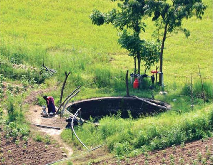
CHALLENGE
Improved watershed management will be crucial to meet growing food demand in India, for example by: recharging local aquifers and improving downstream water flows; decreasing soil erosion; increasing agricultural productivity; and helping farmers adapt to climate change. Experts believe that an additional 102 million tons of food grains need to be produced annually by 2020 to meet national nutritional needs under moderate population growth forecasts, 38 million tons of which will need to come from either rainfed lands or imports.
However, rainfed regions have lagged far behind and have experienced severe resource degradation due to inappropriate land use, poor husbandry and low investments. Longer-term climate change adds another worrying dimension. Climate change requires new adaptation measures by farmers, especially small and marginal farmers who are the most vulnerable to these forecast impacts.
The Integrated Watershed Management Program (IWMP), financed through the Department of Land Resources, currently forms the cornerstone of the Government of India's support to watershed development, covering 27 states and proposing to invest over US$6.6 billion through a 10-year period to 2017. Besides the IWMP, a number of other centrally financed schemes are related to watershed management, agriculture and rural livelihoods, which to varying degrees address development needs in rainfed areas. The IWMP has been slowly rolling out and expanding its reach across India since 2009. But, it has not delivered expected results evenly across the country or to the desired levels. In moving forward to improve the IWMP model and execution, a number of key issues outlined recently by the Planning Commission and various other reports/experts have been identified.
Two key issues are:
Fragmented programming and partial solutions. Given their ecological characteristics, developing rainfed areas requires a broad watershed approach. Large budgets are now available for IWMP and several other schemes for the development of rainfed areas within the Ministry of Rural Development. However, each of these is conceived and implemented in departmental silos without unified mechanisms for coordination and convergence. As a result, these programs do not lead to area development, potential synergies are lost, and investments, interventions, and results remain sub-optimal.
Narrow planning scale. The IWMP is executed through clusters of micro-watersheds (each usually 500 ha to 700 ha) covering an average of 5,000 ha. This scale is appropriate for participatory planning and implementation communities. However, a larger landscape assessment/planning framework ranging up to 25,000 ha is also needed where broader land and water issues can be identified, and a more coordinated approach developed to converge government schemes with the IWMP. The current IWMP model also does not fully incorporate surface and groundwater assessments into management and monitoring activities to guide integrated planning at sub-watershed and micro-watershed scales.
APPROACH
This activity aims to address some of the issues above by helping to:
- Improve intra- and inter-ministerial convergence in watershed management in India;
- Develop landscape level catchment assessment/planning methods and guidelines for India; and
- Disseminate knowledge on good practices in watershed management building on a draft report prepared under a previous PROFOR activity.
RESULTS
The activity was successfully completed. The final report “Catchment Assessment and Planning for Watershed Management” is now available to the left along with a summary report. A launch workshop was held in Washington, D.C., in October 2014. A similar workshop was held in Delhi in December 2014. One article based on this work was published in a national journal in India. In addition, the “Operational Guidelines for Benchmarking Watershed Management Outcomes” prepared by the Ministry of Rural Development of India and the World Bank discussion paper “Watershed Development in India: An Approach Evolving through Experience” can be downloaded from this page.
Some key insights and lessons are:
- Micro-watersheds are the appropriate scale for program implementation with communities, with guidance by larger scale catchment assessments.
- Decentralized and participatory development is a necessary approach for success.
- Invest in participatory, evidence-based micro-watershed plans with communities.
- Invest in capacity building and information sharing to build sustainability and a body of knowledge.
- Invest in comprehensive monitoring and evaluation (M&E) to track implementation and support management.
For stories and updates on related activities, follow us on twitter and facebook, or subscribe to our mailing list for regular updates.
Author : World Bank
Last Updated : 12-18-2017
Share
Attachments
OFFSETS-PUBLIC INFORMATION NOTE.pdf
Download
Biodiversity Offset Users Guide
Mozambique Biodiversity Offsets Roadmap (PDF October 2016)
A National Biodiversity Offset Scheme: A Road Map for Liberia's Mining Sector
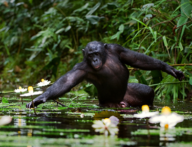
Trouble in the forest seen through the eyes of orphan bonobos
Balancing Mining Development and Forest Conservation in the Congo Basin
Digging In: New Opportunities for Mining and Conservation in Africa
Public information note about the study (PDF Sept 2013)
Authors/Partners
World Bank Africa Region
Biodiversity Offsets Toolkit and Sourcebook
CHALLENGE
In many African countries, native forests are under pressure from rapidly-spreading roads, dams and other infrastructure, as well as the allocation of large forest areas to mining, commercial agriculture, and other non-forest uses. Biodiversity offsets are one of the tools available to address such pressures. Offsets can be used to strengthen protected areas of similar or greater conservation value than the area lost to specific projects. The driving impetus for such offset schemes is usually biodiversity protection, although the associated conservation areas provide additional ecosystem services such as soil and water conservation, flood mitigation, and habitat for sustainably exploitable fisheries. In an era of often flat -- and sometimes declining -- governmental support for forest conservation in general and protected areas in particular, biodiversity offsets provide an underutilized opportunity to mobilize substantial new funding from public infrastructure accounts as well as the private sector.
Biodiversity offsets are not a panacea, nor are they always the best tool available for achieving forest conservation. As part of the “mitigation hierarchy” underpinning the World Bank’s Safeguard Policies and the IFC’s Performance Standards, offsets are considered a last resort, after efforts to avoid, minimize, and restore any significant damage to forests or other natural habitats. Nonetheless, given that many infrastructure, extractive, and other large-scale projects have an inherently large footprint, a biodiversity offset scheme may be warranted (and required by some funding entities).
A key challenge is systematizing and scaling-up biodiversity offsets through a national or other aggregated offset approach in order to overcome limitation like: (i) the high transaction costs often borne by each separate project; (ii) sub-optimal selection of conservation offset areas due to uncoordinated, ad-hoc approaches; and (iii) insufficient participation and ownership by governmental authorities in arrangements negotiated primarily between large private firms and conservation NGOs. The cumulative impacts of multiple (including smaller-scale) projects could also be more effectively addressed through an aggregate offset approach.
APPROACH
Under this activity, the team produced a Biodiversity Offsets User Guide containing key information about biodiversity offsets that practitioners should know about, with references provided where readers could obtain further information. Three case studies of reasonably successful biodiversity offsets were added to the User Guide as annexes. The case studies involved two private sector mining projects (in Liberia and Madagascar) and one World Bank-supported hydropower project (in Cameroon). These case studies are intended to show readers how the concepts explained in the User Guide can realistically be applied to achieve positive results on the ground.
In addition, in response to a strong expression of interest from the Government of Mozambique, this activity also provided legal technical assistance for incorporating biodiversity offsets into the Government’s official Environmental Impact Assessment (EIA) process. Two reports were produced: (i) An analysis of Mozambican environmental legislation with respect to the use of biodiversity offsets; and (ii) a draft revision of the actual EIA regulations.
Finally, two pilot Country Roadmaps were completed to assess the potential for large-scale biodiversity offset systems in Liberia and Mozambique. The Roadmaps are intended as preliminary country examinations of legal and regulatory frameworks, national policies, land use plans, financial structures, and other relevant information.
RESULTS
The research team found that multiple detailed publications already exist about the details and controversies of biodiversity offsets, but that a concise reference with practical advice on how actually to do them was still lacking. This is the void that the Biodiversity Offsets User Guide seeks to fill.
The Liberia Biodiversity Offsets Roadmap emphasizes industrial-scale mining. Since adequate funding for Liberia’s protected areas remains a challenge, biodiversity offsets offer the potential for improved financial sustainability. The Liberia Roadmap outlines a series of steps for scaling-up biodiversity offsets in Liberia; among the most important is the establishment of a national Conservation Trust Fund to enable the reliable and transparent transfer of funds from extractive firms to priority Protected Areas. The new Liberia Forest Sector (REDD+) Project, approved in April 2016 with support from the World Bank and Government of Norway, provides a vehicle for moving forward the Roadmap’s key recommendations.
In Mozambique, existing Conservation Areas (CAs) cover about 26% of the country’s land area, and encompass most types of terrestrial and aquatic ecosystems. However, most are seriously underfunded. The Mozambique Biodiversity Offsets Roadmap (also available in Portuguese) proposes using Mozambique’s BioFund to transfer biodiversity offsets funding from infrastructure and extractive industry projects to selected CAs that are ecologically similar to the project-affected areas. Implementation has begun of the Roadmap’s recommendations, through the Government’s recently revised Environmental Impact Assessment Regulations.
For stories and updates on related activities, follow us on Twitter and Facebook, or subscribe to our mailing list for regular updates.
For stories and updates on related activities, follow us on twitter and facebook, or subscribe to our mailing list for regular updates.
Author : World Bank Africa Region
Last Updated : 02-28-2017
Share
Related Links
Expert Meeting on Taking to Scale Tree-Based Ecosystem Approaches
Taking to Scale Tree-Based Systems in Malawi
Taking to Scale Tree-Based Systems in Rwanda
Sustainability Article: TBEAs as Multi-Functional Land Management Strategies—Evidence from Rwanda
External Related Links
Improving governance for scaling up Sustainable Land Management (SLM) in Mali
Keywords
Authors/Partners
Diji Chandrasekharan Behr (PROFOR), Ecoagriculture Partners, WRI, ICRAF
Taking tree-based ecosystem approaches to scale
CHALLENGE
Land management approaches that use trees have led to an increase in yields and income, an increase in climate resilience, and more carbon sequestration than conventional approaches (thus yielding a ‘triple win’). These tree-based systems (TBS) can assist in improving food security and resilience because they contribute to soil productivity, water availability and genetic variability. They also ensure the overall robustness and resilience of an agricultural system to external shocks. With appropriate policy conditions, these tree-based systems can also assist in diversifying the income portfolio, especially when trees on farms can be sold for timber or firewood. Examples include the planting of the nitrogen-fixing tree Faidherbia albida, which has been shown to double maize yields in Malawi. The same species is being grown on millions of hectares of cropland throughout Niger at densities of up to 200 trees per hectare, which has tripled the yields of the crops growing beneath them. Few of these ‘triple win’ systems, however, have been replicated at scale.
APPROACH
This activity aimed to strengthen the application of TBEA policies in African countries. This involved: (i) examining how existing TBS contribute to enhancing food security and mitigating climate change; (ii) identifying appropriate policy and institutional measures to scale up such approaches; and (iii) improving our knowledge of how agents’ preferences, biophysical characteristics, resource endowments, market incentives, and risk and uncertainty influence the adoption of TBS.
RESULTS
The key outputs from the project are:
- A state-of-knowledge report done in partnership with Ecoagriculture, IFPRI, WRI, CATIE, and ICRAF. The report reviewed over 100 examples of TBS and found that only a small subset of the case studies had quantitative evidence on how these systems generate a triple win (i.e., increased carbon sequestration, improved food security, and income for resilience to weather events). Moreover, while several studies examined the motivations for adoption and offered evidence of how adoption at scale could be achieved, few had looked at adoption that was already occurring at scale and traced the reasons behind these trends. Findings from the review informed an expert meeting on the conditions for scaling up TBS. The report was also disseminated at the Landscapes Forum in Warsaw (a side event at the 2013 UNFCCC COP) and presented at the World Agroforestry Conference in New Delhi in February 2014.
- Country studies for Malawi and Rwanda that include analysis of primary household data, done in partnership with ICRAF and WRI.
The Rwanda study found that the country’s environment is suffering from land degradation, soil erosion, deforestation, loss of biodiversity, and pollution, mainly due to agricultural expansion, livestock farming and unsustainable fuel wood extraction. TBS mainly include agroforestry systems managed by smallholders. The study found that sustained adoption of TBS at scale is only guaranteed if communities collectively recognize tangible benefits such as provisions of fuel and bean stakes, and compatibility with the sustainable intensification of existing farming system, supported by favorable tenure, market, and institutional conditions.
The Malawi study focused on farmer managed natural regeneration (FMNR) approaches because of their low-cost nature and few constraints. The spontaneous scale-up of FMNR in Malawi has been driven by many factors, including declining soil fertility and agricultural production. The study estimated that Malawi could save $71 million per year as part of its Farm Input Subsidy Program (FISP) if participating farmer intercropped maize with Gliricidia trees.
- A brief on the Malawi country report;
- A synthesis report on the framework for scaling up, which drew heavily on the World Resources Institute’s diagnostic for forest restoration and the work conducted by Linn and Hannmann on scaling up; and
- A PowerPoint presentation (with voice-over).
In order to raise awareness about the extent of trees on agricultural landscapes, this project sought to engage and reach development partners and the government counterparts throughout the implementation process. Workshops were successfully conducted, and countries are applying the results. In Malawi, these results will inform the national landscape restoration assessment and strategy/action plan. They will also inform discussions on how a watershed-based comprehensive approach to scaling-up TBS might be pursued through upcoming World Bank support to Malawi, in connection to the FISP in particular.
For stories and updates on related activities, follow us on Twitter and Facebook, or subscribe to our mailing list for regular updates
For stories and updates on related activities, follow us on twitter and facebook, or subscribe to our mailing list for regular updates.
Author : Diji Chandrasekharan Behr (PROFOR), Ecoagriculture Partners, WRI, ICRAF
Last Updated : 05-02-2018
Share
Keywords
Cross-sectoral, governance, green economy, livelihoods, water
Authors/Partners
World Bank
Sustainable Management of Oasis Ecosystems in Tunisia
CHALLENGE
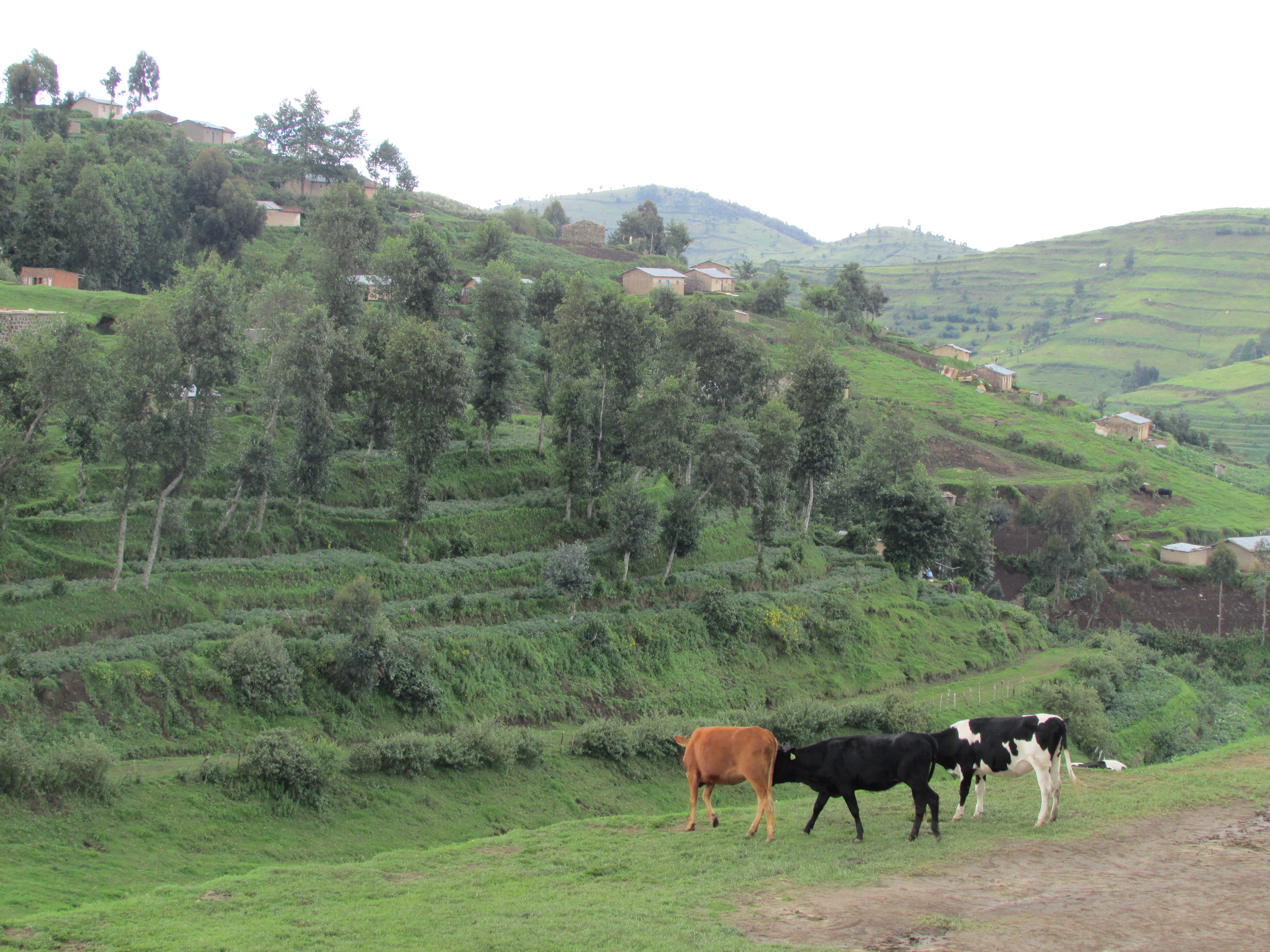
Traditional oases in Tunisia have significant potential in terms of: intensive development leading to job creation; biodiversity support; diversification through innovative and green activities; and tourism based on exceptional natural beauty in the South. However, these oases face a number of threats. Traditional oases are characterized by: old plantations; three-layered vegetated surfaces; high-tree density (400 trees/ha); very fragmented and small sized individual plantations; low yields; and irrigation from declining water tables. In addition, poor marketing opportunities, limited credit, inheritance practices that continually subdivide land holdings and result in poor land management, and inappropriate tourist development have increased the overuse of natural resources, especially water. This, coupled with the breakdown of land management practices, has helped to increase salinization, loss of soil fertility and sand encroachment. Access to crop and livestock resources to cope with these conditions, and the increased pest and disease problems associated with biodiversity loss, are affecting the survival of oasis farmers. Other challenges include: limited opportunities for capacity development; inappropriate policies and legislative instruments; low level of involvement of local populations, particularly women, in decision-making processes; and the continuing loss of traditional knowledge.
APPROACH
This activity seeks to support the development of a coherent and comprehensive national strategy for the sustainable management of traditional oasis ecosystems in Tunisia, or an Oasis Participatory Development Plan (OPDP), which will involve all stakeholders. This strategy will provide a framework for initiatives aimed at supporting and improving the specific ecosystem services that oases provide, conservation and enhancement of the genetic diversity, and improving livelihoods of people living in traditional oases. The aim will be to develop and pilot a new dynamic participatory approach that enhances the resilience of the traditional oasis ecosystem and involves all relevant stakeholders at local and national levels. The studies supported by the project will build on the findings of a number of analytical studies already carried out by the Government and its development partners (such as the GIZ-supported study on sustainable management of oasis systems, including appropriate indicators, and the IUCN & UKaid study on natural resource governance), and enlarge their scope.
RESULTS
An overall strategic vision for the sustainable management of oasis ecosystems has been prepared, stakeholders have reviewed a comprehensive draft of the strategy, and a number of baseline studies have been produced. The OPDP framework was prepared and reviewed by stakeholders, and six oases were selected, representing a variety of Tunisian oasis ecosystems, and are currently under completion. In addition, a communications strategy and an action plan are being developed, with expected completion in March or April 2015.
An overall national strategic vision for the sustainable management of oasis ecosystems has been prepared. Stakeholders reviewed and approved the national strategy. The development of the strategy has been completed in the context of the World Bank (WB)/Global Environment Facility (GEF) Oasis project, by the elaboration of an action plan which was validated during a national workshop in September 2015.
The framework of an OPDP has been prepared and reviewed by stakeholders, and six oases were selected, representing a variety of Tunisian oasis ecosystems. The OPDP includes a number of priority community-based micro-projects, which translate the strategic vision into immediate investment priorities, including sustainable management of water and soils, protection of biodiversity and diversification of local livelihoods).
Several national workshops and regional consultations have been organized to disseminate, present and validate the strategy and the OPDPs with national and local stakeholders. A communication strategy has been developed and disseminated.
For stories and updates on related activities, follow us on twitter and facebook, or subscribe to our mailing list for regular updates.
Author : World Bank
Last Updated : 05-23-2017
Share
External Related Links
Documentary on Rwanda's efforts to plan for climate change (John Liu, hosted on Youtube)
CIFOR Blog: Adaptation research needed to fill gaps
Attachments
Country case study - Burkina Faso_0.pdf
PROFOR_WrkingPaper_Honduras_0.pdf
PROFOR_Brief_HondurasLow_0.pdf
Uso de los bosques para aumentar la capacidad de adaptación al cambio climático _0.pdf
PROFOR_Brief_Honduras_ESP (00000003)_0.pdf
Keywords
Authors/Partners
CIFOR, Trust Fund for Environmentally and Socially Sustainable Development, PROFOR
How Forests Enhance Resilience to Climate Change
CHALLENGE
Developing countries are expected to suffer the most from changes in climatic patterns. The effects of climate change, including higher temperatures, changes in precipitation patterns, rising sea levels and increased frequency of weather related disasters are bound to create risks for agriculture, food, and water supplies. International and national discussions on forests and climate change have largely been focused on reducing emissions from deforestation and degradation and enhancing carbon stocks (REDD+).
Less obvious, yet equally important, is the role of forests in enhancing landscape resilience to climate change—for example at the scale of a watershed. Forests and trees provide environmental services ranging from increasing water quality and quantity in well defined areas, reducing soil erosion, creating micro-climatic conditions that maintain (or in some cases improve) productivity. The sustainable management of forests can also strengthen social resilience, by offering a diversification of revenue sources and product supplies, and building the capacity of local and national institutions.
Forest and tree management could provide a low-cost approach to enhancing resilience of local landscapes to climate change but needs to balance production, livelihood, adaptation and mitigation goals.
PROFOR is conducting a study to improve our understanding of the role of forests in improving the climate resilience of other sectors (mainly agriculture, water, social and biomass based energy sectors). The goal is to inform national adaptation strategies so that they explicitly reflect the value of forest and allocate appropriate resources to facilitate the use of forests for adaptation.
This study will:
• Map forest management approaches and their cross-sectoral impacts
• Identify interactions between forest sector adaptation (or existing management) and resilience enhancement in other sectors (mainly water, biomass-based energy, and agriculture)
• Assess the institutional and financial requirements to identify and implement tree/forest-based adaptation measures
• Identify ways of supporting local knowledge and science that promote tree/forest based adaptation measures with multi-sectoral benefits
RESULTS
The state of knowledge report, synthesis report and case studies are now complete. Briefs for each case study will be available for download soon (the Honduras case study is already available at left in English and Spanish.
For stories and updates on related activities, follow us on twitter and facebook, or subscribe to our mailing list for regular updates.
Author : CIFOR, Trust Fund for Environmentally and Socially Sustainable Development,
PROFOR
Last Updated : 02-24-2017
Share
Related Links
Blog: Adaptation-based Mitigation: the No-Regrets Option
Video: How landscape restoration can break vicious cycle
Keywords
Authors/Partners
World Bank
Adaptation-Based Mitigation in Degraded Landscapes Vulnerable to High Climatic Variation
CHALLENGE
Central America is one of the world regions most vulnerable to climate change impacts. Most countries in the region have high population densities in areas vulnerable to extreme climatic variation, and experience some of the highest rates of deforestation and landscape degradation in Latin America. These conditions directly contribute to exacerbating the negative impacts of destructive climatic events, which affect a significant growing percent of the population, the landscape, and the economy.
Governments of the region are trying to respond to this new reality by designing and implementing effective policies and programs, and uniting international efforts to help communities living in the most vulnerable landscapes to recover their resilience and adapt to increasingly frequent and damaging meteorological phenomena. El Salvador, for example, has launched the National Program for the Restoration of Ecosystems and Rural Landscapes (PREP) and is preparibng REDD+ readiness plans with an emphasis on Adaptation-based Mitigation.
However the institutional efforts, social capital and financial resources that are needed to address these challenges are enormous. For such policies to be successful, coordination and synergies among the different relevant central (e.g. ministries of agriculture, rural development and environment) and local (e.g. municipalities and community organizations) stakeholders is critical. At local levels, steps to induce collective action and governance and improve access to innovative technologies and extension services also need to be taken.
APPROACH
Through analysis of three case studies—one in Honduras and two in El Salvador—PROFOR helped to identify policies and institutional arrangements that can make a difference. The key factors looked at were the heterogeneity of interests and rights of the actors who influence the landscape, social capital in the territory, knowledge and innovation management systems, and the use of direct incentives and other forms of compensation.
In Honduras, the most successful case, stakeholders were able to rally around an urgent social and environmental situation of degraded land: without national government involvement, farmers agreed to stop traditional burning for cropland so that lands could be restored. This change in practice was enabled by local knowledge that documented and offered new options for landscape restoration. The no-burn restoration practice had transaction costs for farmers and required the use of incentives accompanied by regulations, with the territory’s different municipalities applying fines to eradicate the use of burning in agriculture. In the two other cases, different interests among stakeholders impeded collective action.
A set of recommendations regarding the policy and institutional arrangements required for successful landscape-level actions are now informing local, national, and regional dialogues on sustainable landscape planning and management regarding climate change adaptation and mitigation. Additionally, the activity developed guidelines for the contribution of REDD+ to the revitalization of the depressed rural economy, which provided a bridge for working with other government priorities such as education, public security, and productivity.
RESULTS
This activity and its final strategic report will serve as a valuable input for the World Bank’s Forest Carbon Partnership Facility’s REDD+ Readiness Preparation activity in El Salvador. More specifically, the strategic report will aid that country’s REDD+ Readiness in terms of organization among government ministries, consultation with relevant actors, and overall national REDD+ strategy. This activity is ongoing. Findings will be shared on this page when they become available. Follow us on twitter or join our mailing list for regular updates.
For stories and updates on related activities, follow us on twitter and facebook, or subscribe to our mailing list for regular updates.
Author : World Bank
Last Updated : 02-24-2017
Share
External Related Links
The Economics of Climate Change in LAC (2010)
Attachments
web brasil_2030_portugues_0.pdf
Keywords
Authors/Partners
A multidisciplinary and multi-agency team comprising leading experts from the Brazilian National Agricultural and Forestry Research Agency (EMBRAPA), the University of Campinas (UNICAMP) in Sao Paulo, the Brazilian Agency for Space Research (INPE), and the Brazilian Institute for International Trade Negotiations (ICONE), a major think-tank.
Erick Fernandes, Adviser, Climate Change and Natural Resource Management, World Bank (Latin America and Caribbean), managed and oversaw the program.
Impacts of Climate Change on Rural Landscapes in Brazil
CHALLENGE
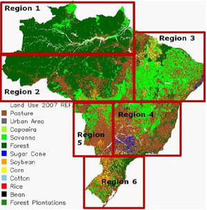
There is growing concern that Brazilian agriculture and forestry sectors are increasingly vulnerable to climate variability and change (eg. a decline in productivity of subsistence crops in northeastern Brazil; increased risk of fire and Amazonian forest dieback). To meet development, food security, climate adaptation and mitigation, and trade goals over the next several decades, Brazil will need to significantly increase per area productivity of food and pasture systems in central and southern Brazil while simultaneously reducing deforestation, rehabilitating millions of hectares of degraded land for cropping and forest plantations in the Amazon, the cerrado, the Atlantic forest, and the Pampas.
However, because of previous climate modeling and data limitations, there was still significant uncertainty associated with the projections for Amazonian rainfall (timing, seasonality) as well as the magnitude and locations of climate impacts in Brazil over the next 50 years. Improved climate change impact assessments were urgently needed to guide policy makers on priorities, geographical targeting (hot spots), and phasing of investments for adataptation and mitigation to climate change.
APPROACH
This activity implemented by the World Bank in partnership with leading Brazilian agencies and supported by PROFOR focused on establishing a robust and integrated decision and policy support framework that could empower Brazil’s policy makers and the agricultural sector to undertake the adaptation necessary to cope with projected climate change.
Its objectives were:
- 1.To refine the available climate change projections for Brazil via the coupling of global, regional, and local scale modeling currently being tested by the Brazilian National Institute for Space Research (INPE) in Brazil and the regional climate program for South America (CREAS).
- 2. To integrate the INPE and CREAS suite of tested global (300 km horizontal resolution) and regional models (50 km horizontal resolution) with the state of the art Brazilian developments in Regional Atmospheric Model (BRAMS) that incorporates aerosol and land cover/deforestation/burning feedbacks for much improved local weather and climate (especially rainfall) projections.
- 3. To make the Brazilian Agro-Eco Zoning Model that is currently used by the Central Bank of Brazil for rural credit programs "climate-smart" by integrating the high resolution climate projection outputs from 1 and 2.
- 4. To make the existing Brazilian Land Use Model (BLUM) climate-sensitive by coupling it with the outputs described above to assess: (a) Climate change induced changes in supply and demand of agricultural commodities at a national level, (b) Changes on the distribution of land use and production (agriculture, forestry, pasture) in Brazil for given supply and demand scenarios, and (c) Economic effects on agricultural and forestry production and profitability.
RESULTS
Projections for land use and forest land cover change, and an assessment of the distribution of land use and production were undertaken. Specifically, previous climate change projections were refined using a global, regional and local scale modeling; Regional Climate Change Scenarios for South America (CREAS) were used for regional and sectoral impact assessments; the Agro Climatic Risk and Vulnerability Zoning Model developed by EMBRAPA and UNICAMP was refined; soils were classified and cropping areas that are less vulnerable to climate change impacts were identified based on temperature effects through 2020 and 2030. A final report, in English and Portuguese, is forthcoming.
FINDINGS
The study showed that while for some crops (soybean and cotton) the projected negative climate impacts to 2020 are likely to be more moderate than previously projected, for other crops (beans and corn), however, the impacts could be significantly more severe than projected in previous studies. All the climate change scenarios simulated in this study resulted in a reduction of ‘low risk’ cropland area in 2020 and 2030.
More specifically, the findings suggested that the South Region of Brazil, currently an agricultural powerhouse, could potentially lose up to 5 million hectares (ha) of its highly suitable agricultural land due to climate change, while Brazil as a whole could have around 11 million ha less of highly suitable agricultural land by 2030. The findings of this study are being incorporated by EMBRAPA into the EMBRAPA/UNICAMP Agroecozone Model to improve the climate projections that underpin the national rural credit and insurance programs in Brazil.
Read the report in Portuguese.
Follow us on twitter and facebook or join our mailing list for regular updates.
For stories and updates on related activities, follow us on twitter and facebook, or subscribe to our mailing list for regular updates.
Author : A multidisciplinary and multi-agency team comprising leading experts from the
Brazilian National Agricultural and Forestry Research Agency (EMBRAPA), the
University of Campinas (UNICAMP) in Sao Paulo, the Brazilian Agency for Space
Research (INPE), and the Brazilian Institute for International Trade
Negotiations (ICONE), a major think-tank.
Erick Fernandes, Adviser, Climate Change and Natural Resource Management,
World Bank (Latin America and Caribbean), managed and oversaw the program.
Last Updated : 02-24-2017